
SPOKANE, Wash — A windstorm tearing through the Inland Northwest on Sunday resulted in treacherous travel, blowing dust and power outages throughout the region.
A High Wind Warning expired at 5 a.m. Monday for cities in Spokane and Kootenai counties and the Idaho Palouse, among others. Peak wind gusts of up to 65 mph are expected in the Spokane area through Sunday night, according to the National Weather Service. Damaging winds could blow down trees and power lines.
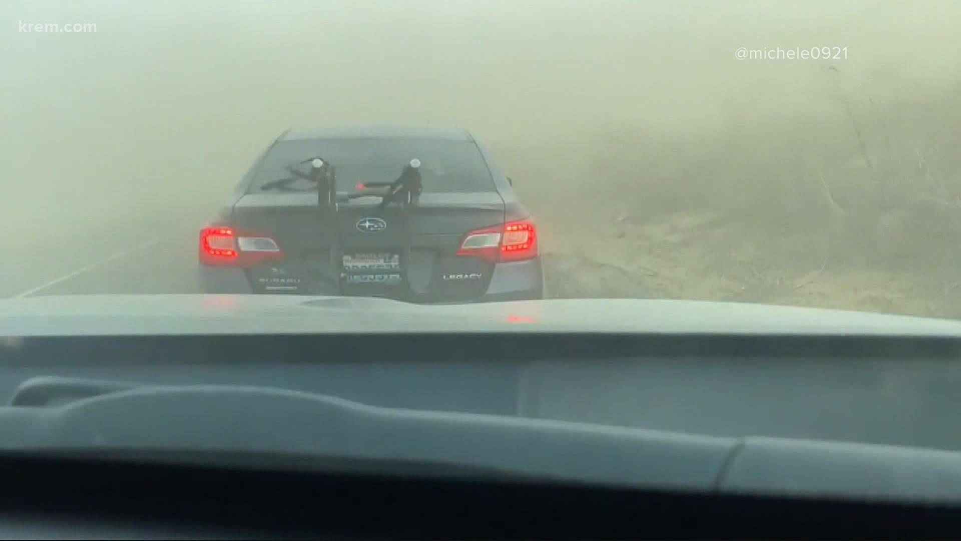
Blowing dust was a concern in Moses Lake and surrounding areas of Central Washington. I-90 reopened from Ritzville to just east of Moses Lake after being closed due to reduced visibility, according to the Washington State Department of Transportation.
The National Weather Service's Spokane office also reported blowing dust and reduced visibility of 1/2 mile to 1/4 mile at about 3 p.m. on I-90 from George to Ritzville and State Route 26 at Highway 395 to Royal City. Wind gusts were reported between 40 to 50 mph.
Thousands of people are without power in parts of Eastern Washington and North Idaho due to the high winds. KREM Meteorologist Thomas Patrick said a gust of 44 mph was reported in the Spokane area at 2 p.m. on Sunday. Peak wind gusts are expected through 10 p.m. on Sunday, according to NWS.
Public Safety Alert issued, Office of Emergency Management activated
A Public Safety Alert was sent to mobile phones in the area on Sunday saying that Spokane County Emergency Management was issuing a warning due to the National Weather Service stating "this storm has the potential to be a high impact event with winds 50-65 mph and gusts to 70 mph between 2 and 8 p.m." They also advised people to stay indoors if possible.
The City of Spokane also advised motorists to treat dark intersections as four-way stops amid reports of traffic signals losing power.
Kootenai County has activated its Office of Emergency Management and is asking residents to call 208-446-2292 to report downed powerlines or trees, blocked roads or other non-emergency incidents related to the storm. This comes as a move to not crowd 911 lines.
Will this windstorm be as bad as January 2021 and November 2015?
Will this windstorm be as bad as January 2021 or November 2015's windstorm? The short answer: no. Those events are upper echelon windstorms, where in both cases Spokane's maximum wind speed was as high as 74 mph. The predictions for Sunday are around 60 mph.
Winds start reaching "damaging" levels around 45mph. That's when the National Weather Service will typically issue Wind Advisories. At 60 mph, that's considered "severe" and High Wind Warnings are issued. Anything about 70-75 is on the "extreme" side for our region.
The strong winds subsided Monday morning but much colder air is in place. Highs will go from the 60s on Sunday to the 40s on Monday, and another round of rain/snow showers are possible late Sunday into early Monday morning.