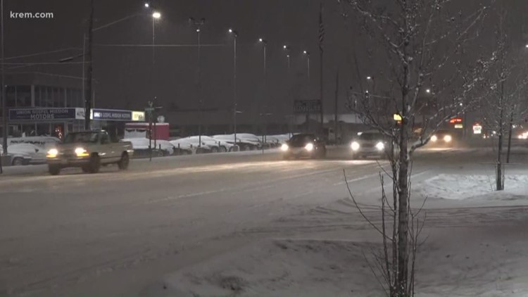
SPOKANE, Wash. — The Inland Northwest weather has strayed away from extremes for the past week or so, and while nothing extreme is in the forecast, it's worth noting the timing of our next round of light snow. Early Monday morning makes the impacts as big as possible.
The snow kicking off the week is the beginning of another slightly unsettled weather pattern that isn't unlike what we just experienced this week. Scattered showers and occasional downbursts but nothing that would be considered a washout.
The Sunday night and Monday morning snow is the same.
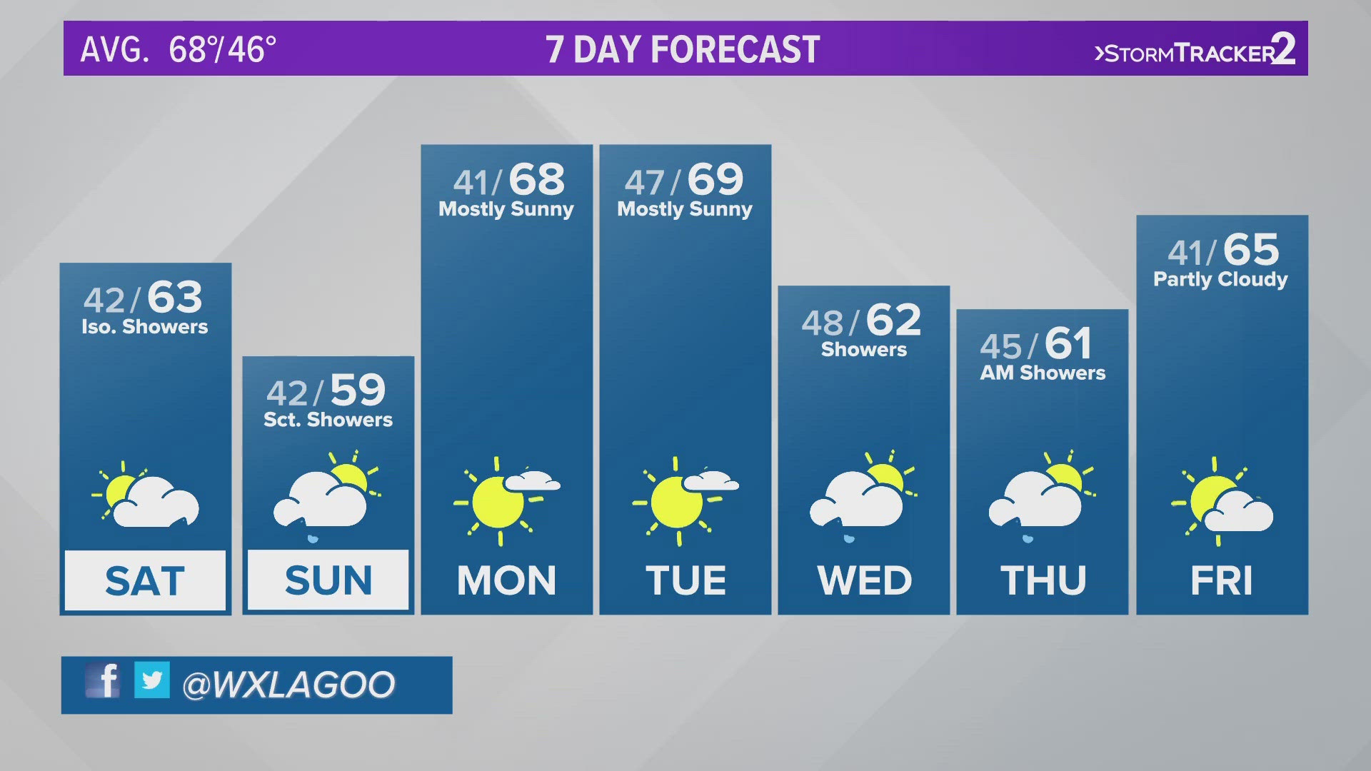
Areas expecting light snow will be the Spokane area, the Palouse, northeastern Washington mountains, and most of North Idaho. Forecast models have all valley and low lying areas at 1 inch of snow or less except for mountainous areas in north-central Idaho.
The snow began overnight and started winding down long before the sun came up. Less than an inch all said and done, the showers should taper off by the morning rush.
Since the light snow will fall in the overnight hours, it'll be likely some side streets may be slick or icy during the early Monday morning commute. But as temperatures warm above freezing and traffic increases on the major roads, the snow will turn to slush and water almost instantly.
A few light showers are still possible throughout the day. Don't expect any additional accumulation. Temperatures in the mid-30s means anything that falls will quickly melt.
The next round of showers moves through on Tuesday. Temperatures will be warm enough that Tuesday's showers will be rain. High-elevation snow stays in the forecast, so if you are driving over any mountain passes keep a close eye on the conditions you may encounter a coating of snow on the roadways.