
SPOKANE, Wash. — Since August, meteorologists have been monitoring the potential for a La Niña winter. Now that it's November, it's a sure bet at this stage of the forecast.
What is La Niña?
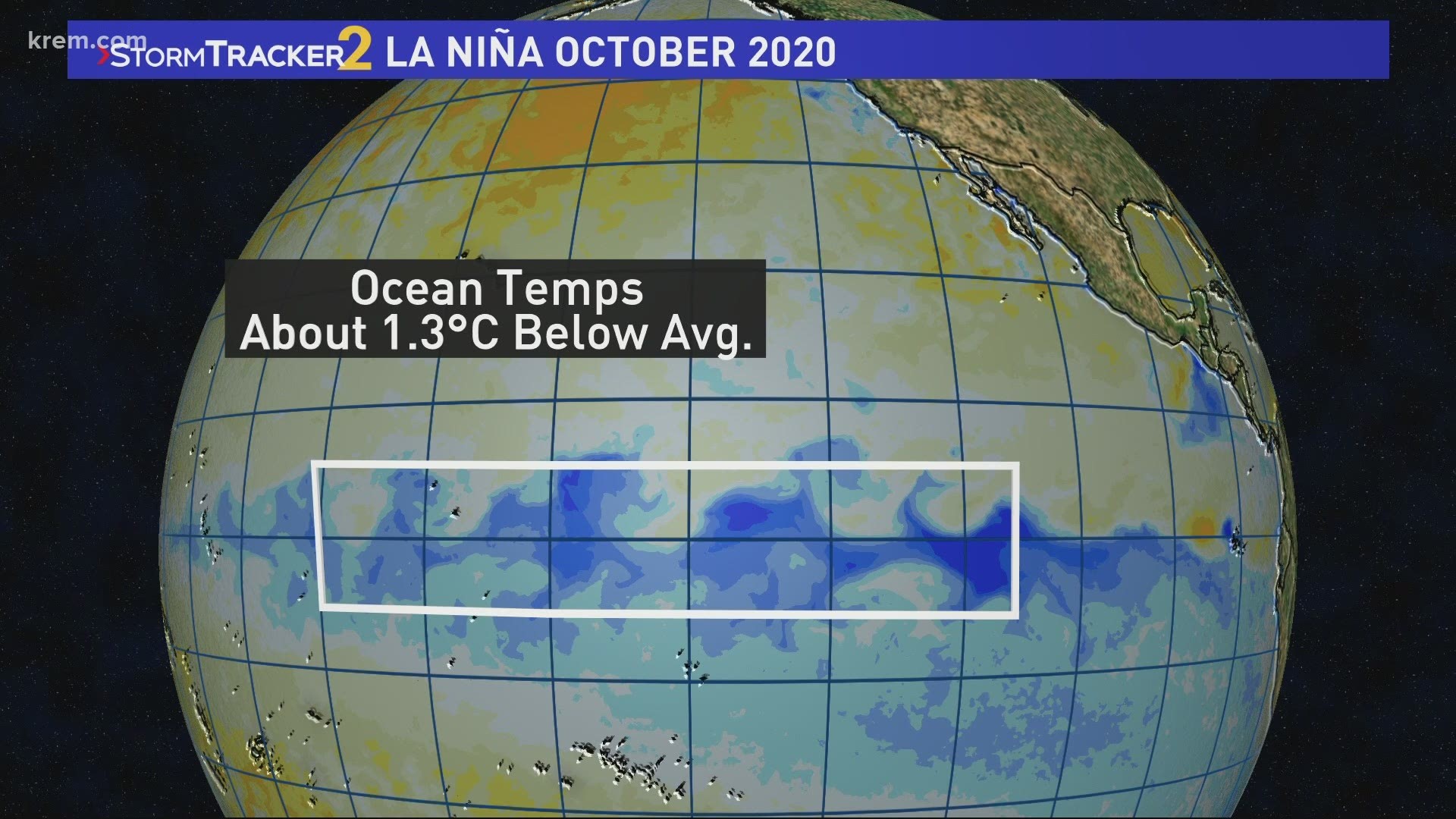
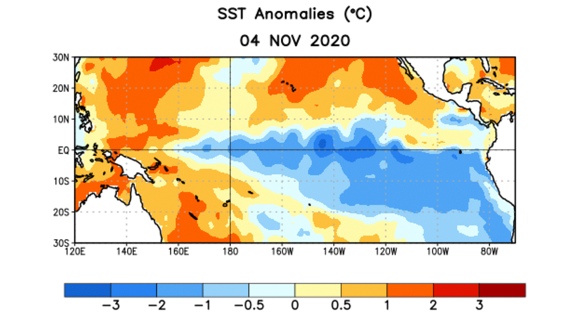
La Niña is the general weather pattern shift that occurs when water temperatures along the Equator in the Pacific Ocean are below normal. It's the opposite of El Niño, when water temperatures are above normal.
This is caused by an upwelling of colder water along the western coast of South America and the waters travel westwards along the trade winds into the middle of the Pacific Ocean.
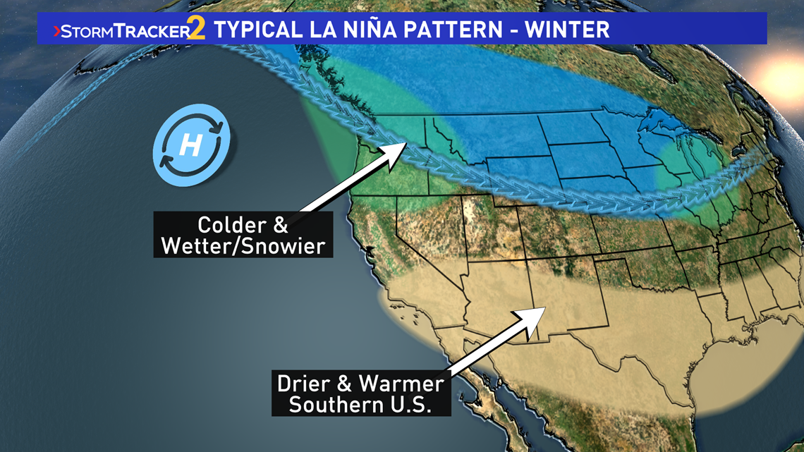
This has a general impact and adjustment to how the jet streams are positioned across the globe and tends to have a noticeable affect on the winter months across the North American continent.
The Climate Prediction Center, the branch of NOAA that monitors the El Niño Southern Oscillation (ENSO for short), noted that La Niña conditions strengthened in the month of October. Temperatures were approximately 1.5 degrees Celsius below normal in the region that generally is most important, and that is considered a strong La Nina.

Meteorologist says that La Niña conditions have a 95% chance to remain through March and about a 65% chance to continue into the spring through May.
What does this mean for Spokane?
For Spokane, and the Pacific Northwest as a whole, La Niña tends to lead to a colder and wetter than average winter time. That correlates to a snowier winter for the Inland Northwest and surrounding mountain ranges.
Two of the snowiest winters in recent memory, the winter of 2007-08 and 2008-09 (which is Spokane's record snowiest winter) were both La Niña winters.

But it's important to note that while La Niña favors the colder and snowier season overall, the strength of La Nina doesn't correlate to more snow. The record snowiest winter of 2008-09 was during a weak La Niña year that was in the process of ending. But the 2007-2008 was in the middle of a very strong La Niña pattern, similar to the La Niña setting up for this season. Both of those winters had more than 90 inches of snow in Spokane.
Spokane averages just shy of 45" of snow a year.
Watch KREM 2 News on Thursday, Nov. 19 to see Chief Meteorologist Tom Sherry's annual winter weather forecast for Spokane and the Inland Northwest.