
SPOKANE, Wash. — After some 30 day stretch of very dry weather, a significant pattern change for the area is going to result in near daily chances for rain over the next week. In the midst of this wetter weather, Thursday stands out as the day with the greatest risk for thunderstorms and flooding.
The wave of energy in question is a two-parter. Late Wednesday night and early Thursday morning will see scattered showers and limited thunderstorms at first. The second wave is far more potent, and will result in periods of heavy rain and thunderstorms by later afternoon and into the evening.

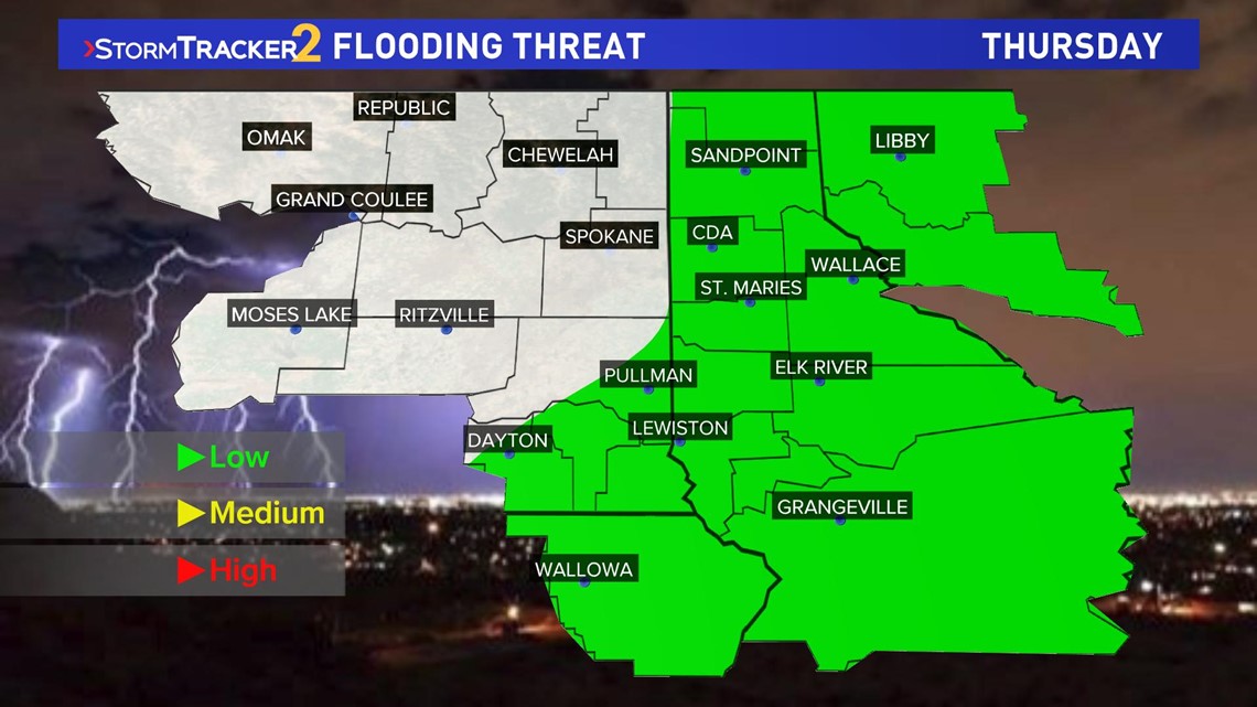
Locations that have the highest chance for thunderstorms is over southeastern Washington, the Palouse, and all of North Idaho. The areas that see thunderstorm pass overhead may easily see a half inch of rain or more in a short period of time. This may lead to some localized flash flooding.
Other risk factors for Thursday's thunderstorms will be lightning, small hail, and gusty winds.
RELATED: Tom's BBQ Forecast 2019