Editor’s note: This story is no longer being updated. Click here for the latest forecast timeline.
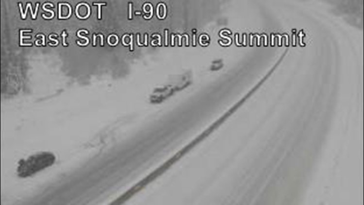
SEATTLE - A Winter Storm Warning is in effect for the Cascades from 6 p.m. Friday through Sunday as heavy snow is expected to fall in the mountains. Between 18 to 36 inches of new snow is anticipated with strong gusty winds.
Snow levels rising to 3,000 feet may briefly cause freezing rain at Snoqualmie Pass in addition to the snow. Also watch for freezing rain over parts of Highway 101, near Amanda Park.
On Saturday afternoon, a cold front will push in to take snow levels lower, gradually from 3,000 feet to 2,000 feet. The cold front will bring a round of rain, wind, and mountain snow as it passes Saturday afternoon and evening.
Anyone looking to travel over the passes over the next few days should stay up-to-date with the latest travel alerts and potential closures from WSDOT.
RELATED: Western Washington forecast
The weather service said there is still some snow level uncertainty over the Olympics and for areas around Snoqualmie Pass and to the south this weekend. A region of warm surface air may linger over the areas long enough that snow totals could end up on the lower side of the forecast. Conditions could also favor a wintery mix with freezing rain at Snoqualmie Pass Friday night into Saturday.