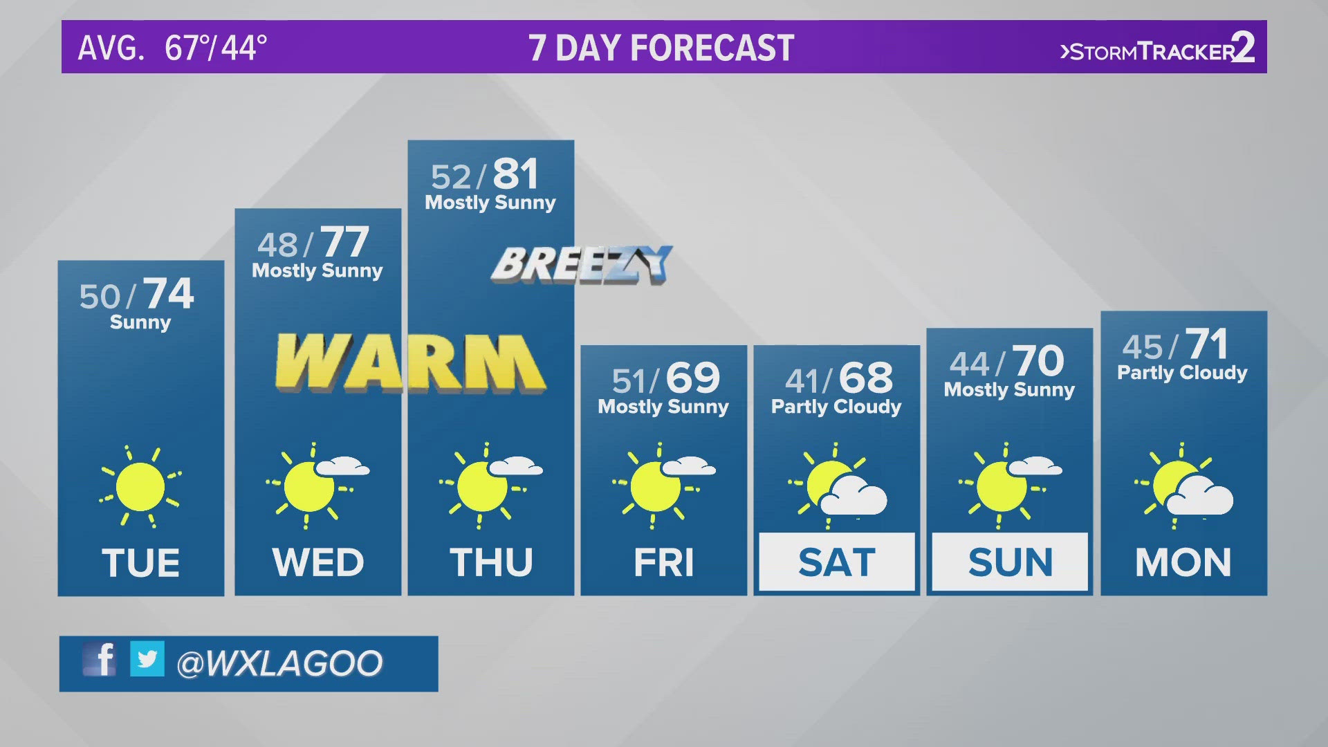
SPOKANE, Wash. — Another spring day with graupel in the forecast!
Many people across the region reported on Tuesday afternoon that snow pellets or "graupel" was precipitating, mixing in some with rain showers. Wednesday and Thursday will see exactly the same between about 11 a.m. and 7 p.m. And if you're watching doppler radar, you'll notice that will display as snow, but the precipitation type is likely graupel.
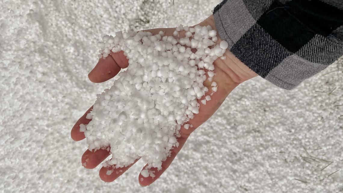
What is graupel?
Graupel is also known as "soft hail" and resembles snow in a pellet form. It has about the same texture as Dippin' Dot ice cream. It's not as solid as sleet, it's far more malleable. As for how it's formed, those cumulus clouds will suspend super-cooled water droplets in the atmosphere and they will freeze into a snow crystal.
Graupel showers can be particularly snowy for a brief period of time, but it never sticks around very long, melting away after a few minutes or an hour or two. The ice pellets are soft enough that they tend to melt if you try to pick them up in your hand (just like how Dippin' Dots would melt in your hands too).
Graupel is notorious for being active in the early-spring season. The colder afternoon can support frozen precipitation with more convection-style clouds like cumulus instead of the stable and gray stratus clouds. Because of the morning sunshine, the precipitation, be that rain or graupel, likely gets started around 11 a.m. to 12 p.m. each of these next two days.

WATCH RELATED: Frosty mornings with more pop up showers expected in the coming days