
SPOKANE, Wash. — Wildfire season is underway in both Washington and Idaho.
There are more than a dozen fires burning in Eastern and Central Washington, Idaho and Montana.
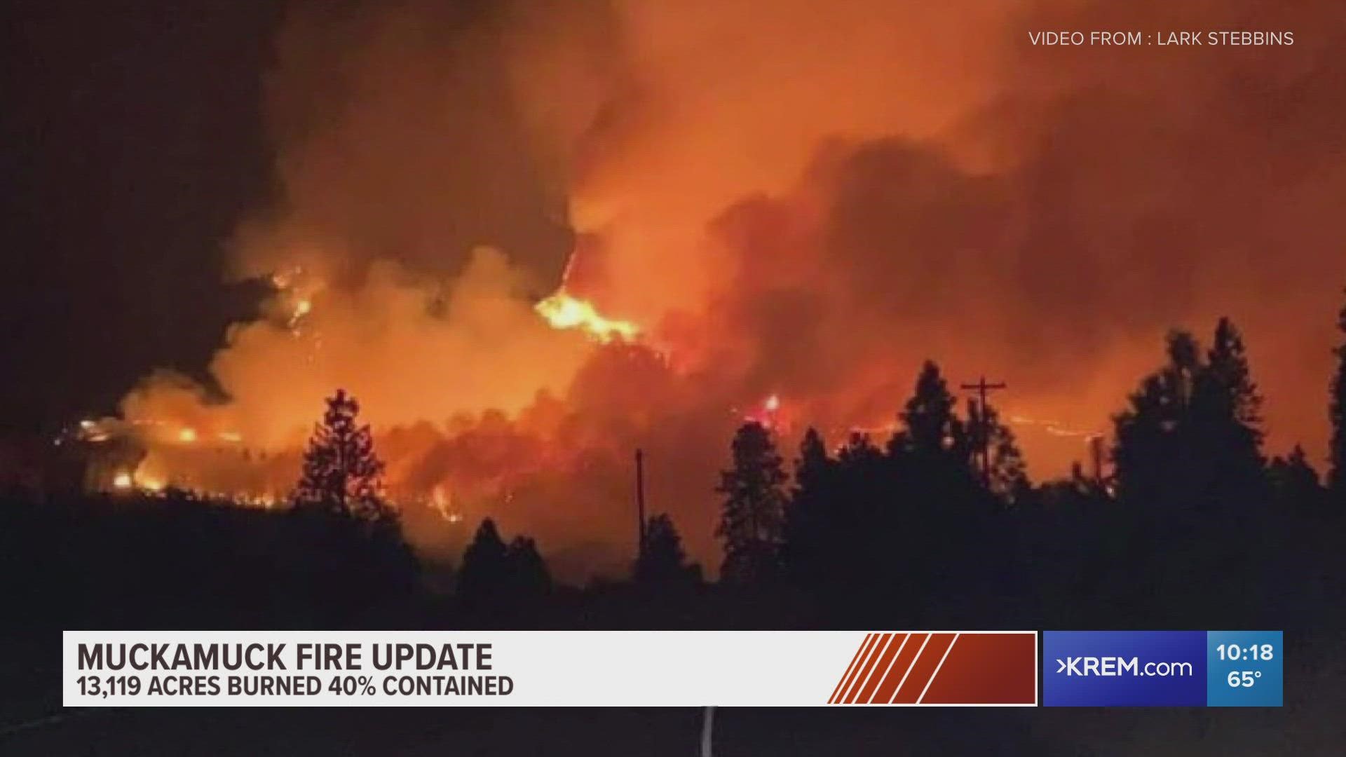
The Pacific Northwest is no stranger to catastrophic events. More than 800,000 acres burned in 2020's deadly wildfire season. Fire officials believe his year may be significantly worse.
Here is a running list of wildfires burning in Washington and Idaho:
Washington
Corkscrew Fire
- Location: North of Corkscrew Canyon and State Highway 231
- Size: 15,782 acres
- Containment: 92%
- Cause: Under investigation
- Evacuations: Evacuation areas have been reduced. Click here to see the map.
- Closures: The following roads are closed: Rail Canyon, McAlister, Scotts Valley and Casberg-Burroughs at the Williams Valley intersection.
- Shelter info: A temporary Red Cross shelter is set up at Mary Walker High School. The Springdale Rodeo Grounds and the Chewelah Veterinary Clinic are available for animals that need to be evacuated. On the Spokane Reservation, the Wellpinit Middle/High School has been opened up for evacuees as well.
Green Ridge Fire
- Location: Green Ridge area, 30 miles east of Walla Walla.
- Size: 39,546 Acres
- Containment: 35%
- Cause: Lightning
- Evacuations: A Level 3 evacuation (Leave now) notice for the following areas: Northwest corner of the Columbia and Garfield County border south to the Tucannon River Trail. Diagonally to the southeast along the Tucannon River Trail and north along the bear creek trail to the intersection of the 40 road. This will continue north on the westside of the 42 road to Pataha Spur Rd in the area of Iron Springs. Around the 040 road to the 4016 road, following the 4016 road to the 40 road and north to the forest boundary. •To include the Stentz Spring and Clear Water communities. A Level 2 evacuation (Be ready to leave) notice for the following areas: Starting from the northwest area of the Columbia County line on the Blind Grade Road extending south to Umatilla National Forest boundary east to the Baker Pond Campground. South on the 40 road to the 4016 road, 4016 road around to 040 Road to 42 Road. Continues south on the eastside of the 42 Road to Lickford Road (41 Road) and northeast to Asotin County line. North on the county line to Knotgrass Ridge Road west to include Kimble Road area. Kimble Road west to the Highway 128 going northeast to Bosley Grade Road. Bosley Grade Road to Mountain Road continuing to the intersection of Lineville Ridge Road to the Columbia County line. This includes the Stentz Springs, Rose Spring and Baker Pond communities. A Level 3 evacuation notice for the following areas: Beginning at the north Umatilla National Forest boundary, from Tucker Road to the Garfield County line boundary. The west side continues to follow the west forest boundary south to where Walla Walla Rd and N Touche Road intersect, diagonal to Midway Campground at Skyline Drive. It will continue east through the Horse Ridge Trail to the Garfield County line. A Level II evacuation notice has also been issued for the following areas: Everything northwest of Chase Mountain to where Walla Walla Rd and N Touche Road intersect within Umatilla National Forest boundary. A Level I evacuation notice for the following areas: North of the Umatilla National Forest boundary following the Maloney Mountain Road turning into Hartsock Grade Road and follows east and south around the Garfield County Line back to the forest boundary.
- Closures: Portions of the Pomeroy Ranger District and the Walla Walla Ranger District remain closed.
- Shelter info: None
Summit Trail Fire
- Location: 17 miles West of Inchelium
- Size: 45,815 Acres
- Containment: 52%
- Cause: Lightning
- Evacuations: Evacuation orders lifted
- Closures: Sitdown Creek Road is closed at County Highway 99. Some recreation and parking areas may be closed to public access. Expect delays and please use caution when driving as firefighters will be working along the road.
- Shelter info: Inchelium Longhouse and Community Center – 9 Community Loop, Inchelium,Washington (509) 936-2919.
Whitmore Fire
- Location: 14 miles west of Nespelem
- Size: 58,280 Acres
- Containment: 75%
- Cause: Lightning
- Evacuations: All evacuations are lifted.
- Closures: None
- Shelter info: Paschal Sherman Indian School 169 North End Omak Lake Rd, Omak, WA 98841. Take animals to the Nespelem Rodeo Grounds, Schoolhouse Loop Road, Nespelem, WA.
Walker Creek Fire
- Location: 1.5 miles SE of Lake Bonaparte
- Size: 23,412 Acres
- Containment: 30%
- Cause: Under investigation
- Evacuations: Level 3 Evacuations Remain in Effect for Spur and Walker Creek Fire Areas
- Closures: None
- Shelter info: An Evacuation Center has been opened at the Holy Rosary Parrish Hall in Tonasket by the Red Cross.
Cedar Creek Fire
- Location: Okanogan County near Mazama
- Size: 55,187 Acres
- Containment: 80%
- Cause: Lightning
- Evacuations: The community of Mazama (west) remains at a Level 1 evacuation status.
- Closures: Bitterroot Lane, Daisy Place, Elbow Coulee Road, Lodgepole Drive, Long Leaf Lane, Mugo Road, North Blackjack Road, Nighthawk Ridge Road, Pond Road, Pumphouse Road, Red pine Cr, Rocky Top Rd, Rodeo Drive, South Blackjack, Short Leaf Road, Sugar Pine Road, Summer Road, Timber Creek Lane, Umbrella Road, Whitebark Lane and Yellow Leaf Road.
- Shelter info: A Red Cross Shelter is in Stand-by status at the Methow Valley Elementary School in the Eagle Gym. Call 509-670-5331 to contact the shelter.
- Location: 5 miles north of Winthrop
- Size: 70,186 Acres
- Containment: 70%
- Cause: Undetermined
- Evacuations: Click here for a map of evacuation areas
- Closures: A Forest Area Emergency Closure has been issued by the Okanogan- Wenatchee National Forest which closes the use of multiple roads, campgrounds, and trails.
- Shelter info: There is a stand-by shelter located at the Methow Valley Elementary School in the Eagle Gymnasium.
- Structure loss and injuries: 3 structures burned
Idaho
- Location: 40 miles southeast of Grangeville and 15 miles south of Elk City, near the community of Dixie
- Size: 43,430 acres
- Containment: 63%
- Cause: Lightning
- Evacuations: Evacuation orders lifted
- Road closures: Dixie road is open intermittently at this time. The fire is approximately 200 feet from the road and if it gets to the road, the road will be closed until further notice. A portion of the Red River Ranger District and portions of several other ranger districts of the Nez Perce-Clearwater National Forests are under closure.
- Shelter info: None
- Structure loss and injuries: None
- Location: 7 miles north of Hope, Idaho
- Size: 6,674 Acres
- Containment: 40%
- Cause: Lightning
- Evacuations: Level one "get ready" status: Stove Rd, Lewiston Trail, Little Flume Creek Road, the 2000 through 4000 block of Flume Creek Rd, all of Early Breakfast Creek Rd, Cross Mountain Road from Flume Creek Rd to Stove Road.
- Road closures: From the Bonner County Sheriff's Office: Trestle Creek Rd, Trestle Creek Lane & Star Ridge down to Highway 200, may immediately return home. These locations are now in the pre-evacuation "SET" status. Road Closure remains in effect. Only homeowners are allowed access.
- Shelter info: None
- Structure loss and injuries: 2 injuries
Cougar Rock Complex Fire
- Location: 17 miles Northeast of Elk River, ID
- Size: 8,178 acres; 11 total fires in complex
- Containment: 63%
- Cause: Lightning
- Evacuations: None
- Closures: There is a Temporary Flight Restriction in place for the air space over the fires to lessen impacts to local aviation operators. Clearwater County Sheriff has issued two closures for firefighters and public safety: Granddad Bridge on the Dworshak Reservoir and Captain’s Cabin near Elk River. These roads remain open for fire and industrial traffic. Five additional closures are in place for public and firefighter safety: 1) St. Maries River Road route 382 from the junction of route 301 to the junction with Forest Service Road (FSR) 3311; 2) FSR 3325 from the junction of route 301 to the junction of FSR 3335; 3) FSR 3335 from the junction of 3325 to FSR 3328; 4) FSR 3328 from the junction of FSR 3325 to the terminus of FSR 3328; and 5) FSR 384 from the junction of route 301 to FSR 3328. All method of travel is prohibited.
- Shelter info: None
- Structure loss and injuries: Unknown
Leland Complex Fire (Made up of Sand Mountain and Pine Creek fires)
- Location: Pine Creek drainage of Leland advancing south toward the Clearwater River and east toward the Bedrock area, approximately 2.5 miles southeast of Julietta, Idaho.
- Size: 3,514 acres
- Containment: 88%
- Cause: Lightning
- Evacuations: None
- Closures: Sand Mountain Fire and Johnson Creek Fire area roads/trail/campgrounds, including Laird Park and PotlatchDeltic leases, remain closed to the public.
- Shelter info: None
- Structure loss and injuries: Unknown
Character Complex Fire
- Location: 3 miles North of Kellogg and 1 mile south of Coeur d'Alene River
- Size: 11,895 acres
- Containment: 62%
- Cause: Lightning
- Evacuations: Eagle Creek and West Fork Eagle Creek residents remain in “Ready” status; however, all residents should remain vigilant to the potential for changing conditions. According to the Shoshone County Sheriff, residents within the Coal Creek – Prichard Zone (from approximately mile marker 12 to mile marker 22) are currently in “Set” status but should remain alert for changing conditions and potential growth. Fire managers and Shoshone County Sheriff’s Office have prepared a population protection plan for both fire areas.
- Closures: Road, trail and area closures are in effect on Idaho Panhandle National Forest lands around the fire areas. Closure orders and maps are posted on InciWeb and on the Idaho Panhandle National Forest Facebook page. The Shoshone County Sheriff’s Office has closed the following roads: Eagle Creek Road, Montgomery Ridge Road, and Bobtail Road at Prichard Creek for the safety of private landowners and firefighters working in the area.
- Shelter info: None
- Structure loss and injuries: 0
Toetly Fire
- Location: Near Worley and Plummer
- Size: 750 acres
- Containment: 35%
- Cause: N/A
- Evacuations: There are no evacuations at the moment. The Coeur d'Alene Tribe will give updates about future evacuations on their Facebook page.
- Closures: From Ellis Lane off Highway 5, encompassing Heyburn State Park up to Conkling Park Road.
- Shelter info: The tribe will not be setting up a shelter at the moment. However, they will have a donation center to help the crews fighting the fire at Tribal Headquarters in the Tribal Council Offices. They say they are in need of water and other drinks like Powerade and Gatorade.
- Structure loss and injuries: The tribe confirmed one structure and a couple of vehicles have been lost in the fire. There have been no injuries.
Montana
Burnt Peak Fire
- Location: 9 miles southwest of Troy, MT/ Keeler Rattle drainage/ southeast of Burnt Peak
- Size: 4,097 acres
- Containment: 32%
- Cause: Lightning
- Evacuations: Residences in North Fork Keeler Creek have been placed on pre-evacuation notice. All area residents should be ready to leave if evacuations are necessary. Residences on East Side Road, Kilbrennan Lake Road, Seventeen Mile Creek, and Sylvanite are on pre-evacuation notice. All residents should be ready to leave if evacuations are necessary. These area roads are not open to the general public.
- Closures: For the safety of firefighters and the public, the Kootenai National Forest enacted an area closure that includes: North Fork Keeler Creek (404), Keeler/Rattle Creek (473), and Lime Butte (4735) roads.
- Shelter info: None
- Structure loss and injuries: None
Granite Pass Complex
- Location: Multiple locations near Lolo Pass
- Size: 5,910 acres
- Cause: Lightning
- Containment: 25%
- Evacuations: For latest on fire evacuation in the area Missoula County Sheriffs Office Facebook
Sign up for the KREM 2 News 2 Know e-mail newsletter, and never miss top stories for Spokane and North Idaho: