SPOKANE, Wash. — Consider this a case study of Spokane's weather on Sunday, Feb. 23. Between noon and 1 p.m, Spokane saw rain, hail, thunderstorms, and snow. And for some, you saw thundersnow!
What is thundersnow? Simple, it's a thunderstorm while it's still snowing. And that's very rare!
Here's where the science comes in the play... Thunderstorms are created with atmospheric instability. Instability is achieved by a difference in temperature over the height of the atmosphere. In the summer time, that's easier to accomplish with a warm (and humid) surface temperature, and a cold jet stream overhead.

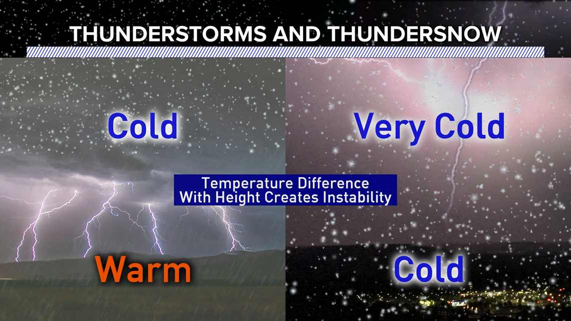
So in the winter, when it's cold enough to snow, it needs to be extremely cold aloft to achieve the same effect and to create lightning and thunder while it's snowing.
And trust me, it's rare. I've only seen thundersnow about eight times in my entire life.
As for the sudden switch from heavy rain to heavy snow Sunday afternoon, that too is a result of thermodynamics.
At 12:27pm, Spokane International Airport reported a temperature of 40 degrees with moderate rain and hail. Sixteen minutes later at 12:43pm, it was 33 degrees and snowing.
That drop of temperature is common though. Much like how a shower on a hot summer day cools us off, the temperatures drops as the rain and snow falls through it. So when we're just above freezing, the intense precipitation causes the switch between rain and snow.