
SPOKANE, Mo. — Friday will bring windy weather to Spokane and surrounding areas.
A Wind Advisory is in effect for a majority of the Inland Northwest. That remains in effect until 7 p.m. Friday for Spokane, Moses Lake, and the northern Columbia Basin areas. Pullman and Asotin areas will remain under the advisory until 9 p.m. tonight.
Southwest winds will be sustained between 20-to-30 mph with 50-mph gusts at times. This may cause limited tree damage, power outages, and a small potential for dust storms in central Washington.
Winds are not expected to be as strong or produce as much damage as those during the windstorm on Tuesday, when wind gusts were on the order of 50-60 mph.

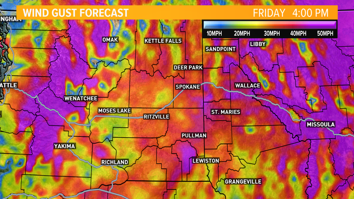
High-profile vehicles may experience difficulty driving during the afternoon and early evening. There may be localized reductions in visibility due to blowing dust in the western Columbia Basin and blowing ash near burns scars of the Cold Springs, Pearl Hill and Greenhouse Fires.
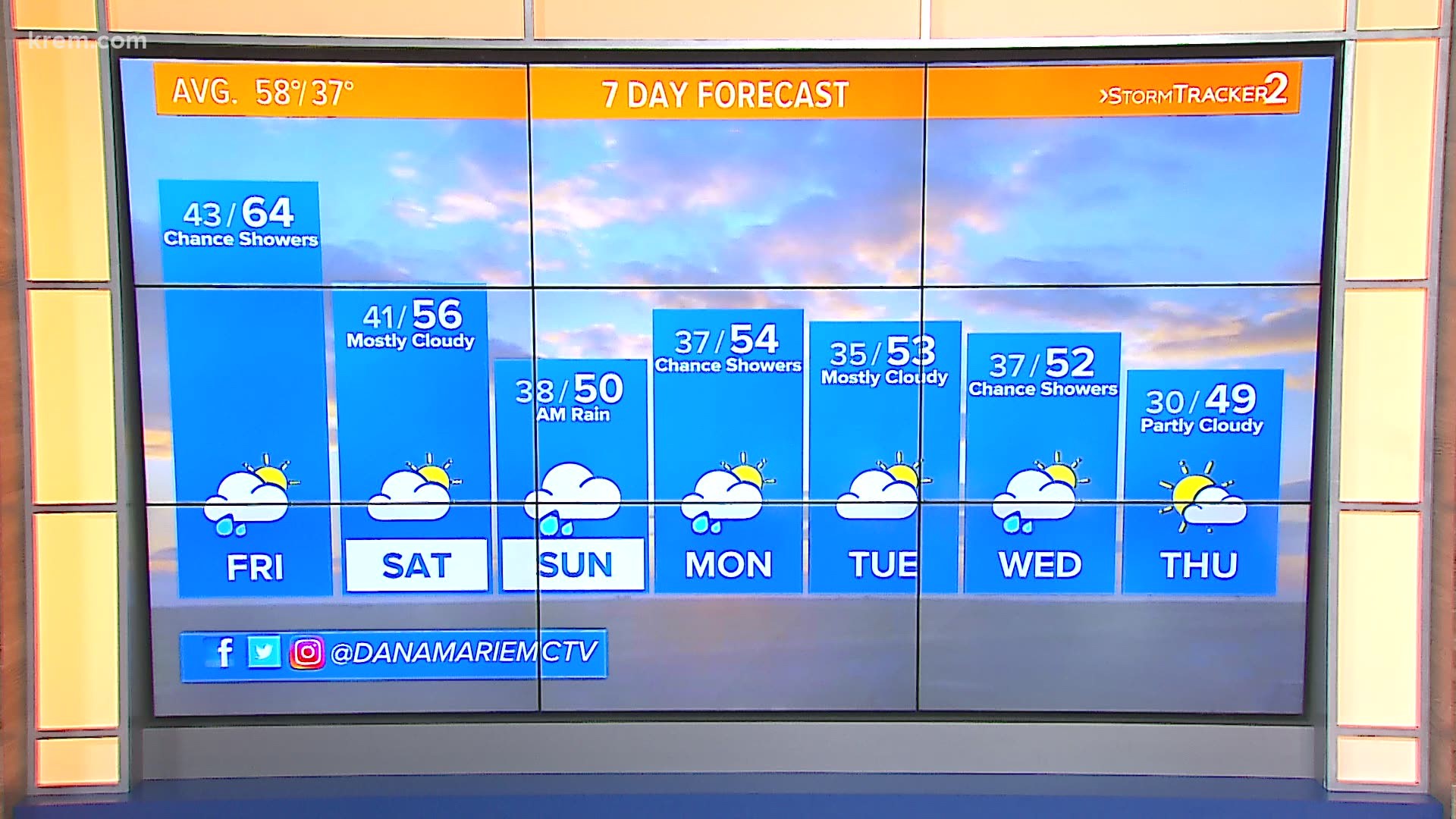
Friday's temperatures will be the warmest for a while, with highs in the low-to-mid 60s. Highs will be just low-to-mid 50s for the rest of the forecast and may be in the 40s next week.
A few light scattered showers will make their way into North Idaho on Friday afternoon with a very low chance for the Spokane area.
Rainfall on Saturday night and Sunday morning will be very cold at about 38 degrees. If the temperature inches any closer to 32 degrees, a few snowflakes might start to mix in. Snow level will drop to about 3,500 to 4,000 feet.