
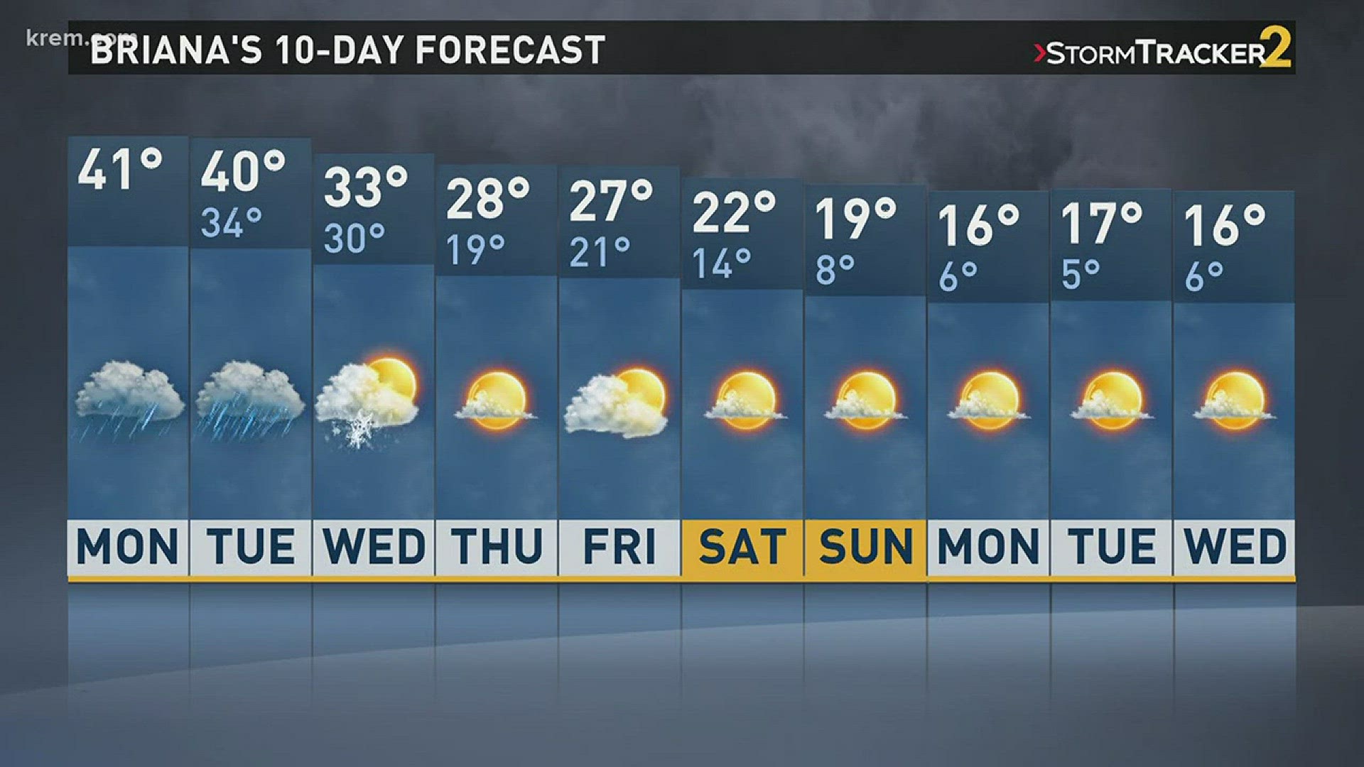
SPOKANE, Wash.— Watch for snow, slush and ice on the roads Monday.
A lot of the snow in Spokane and Coeur d’Alene will melt over the next 48 hours.
A warmer and windier weather pattern will take over for most of the southern valleys.
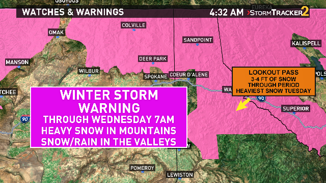
Northern valleys including Deer Park, Chewelah, Sandpoint, Omak and Bonners Ferry could see five to ten inches of snow through Wednesday morning.
Snow will return to the north and in the mountains Monday night.
Tuesday will be the wettest day of the week.
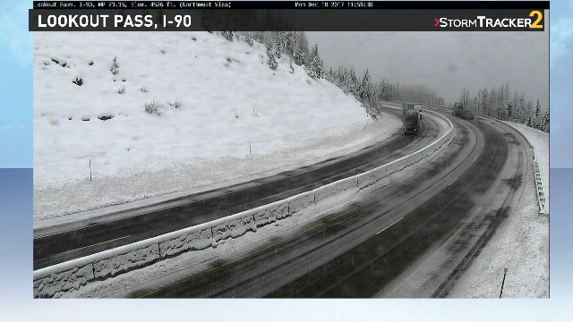
Lookout Pass and surrounding area mountain passes could see three to four feet of snow Wednesday.
A Winter Storm Warning goes into effect Monday night for North Central Washington, North Eastern Washington and Idaho Panhandle mountains.
Mostly rain can be expected Tuesday in Spokane, Coeur d’Alene, Moses Lake, and along the Palouse.