SPOKANE, Wash. — With lots of snow still on the ground from last week's huge winter storm, the next batch of snow is arriving Thursday for Spokane and the Inland Northwest.
This time around, it's not as severe, but most locations will see another 4" of snow on average, with North Idaho likely getting the most.
Drivers should be prepared for tough conditions on the roads, particularly during the afternoon and evening hours.
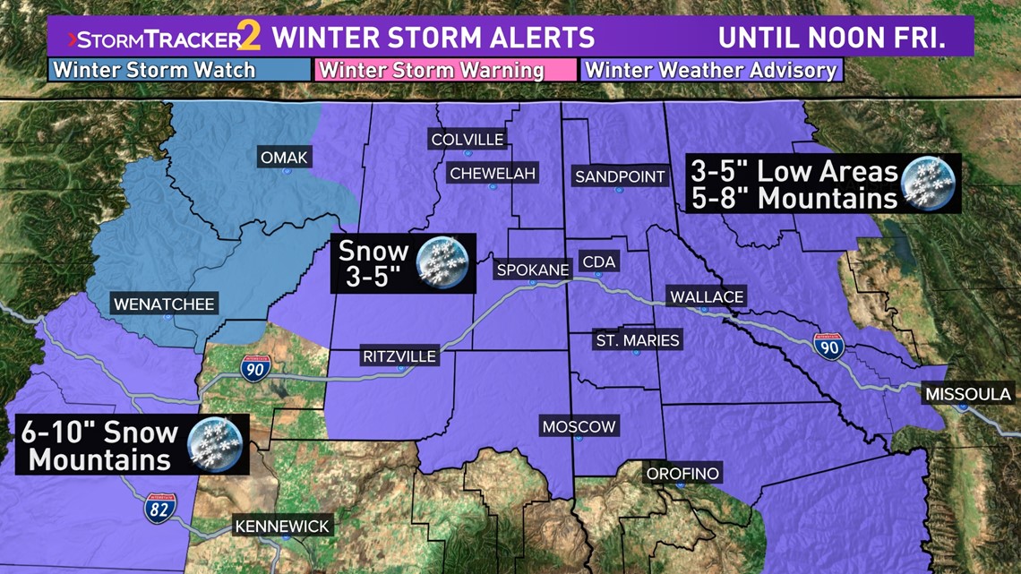
Alerts
Winter Weather Advisories are in effect for most of the region as breaks down like this:
Now until 4am Friday for central Washington, including Ritzville and Grand Coulee.
12pm Thursday until 12pm Friday for all of eastern Washington and North Idaho. This includes Spokane, Coeur d'Alene, Pullman, Sandpoint, and Wallace.

Timing
The snowstorm should arrive before 10 am on Thursday in central Washington. Spokane will see snow around the noon hour, while most of North Idaho won't see snow until the afternoon hours, by 4 pm at the very latest.
Heavy snow is expected to continue for the rest of the day Thursday but should end late Thursday evening or Friday morning. North Idaho locations are most likely to see Friday morning snow and thus snow totals are higher there.
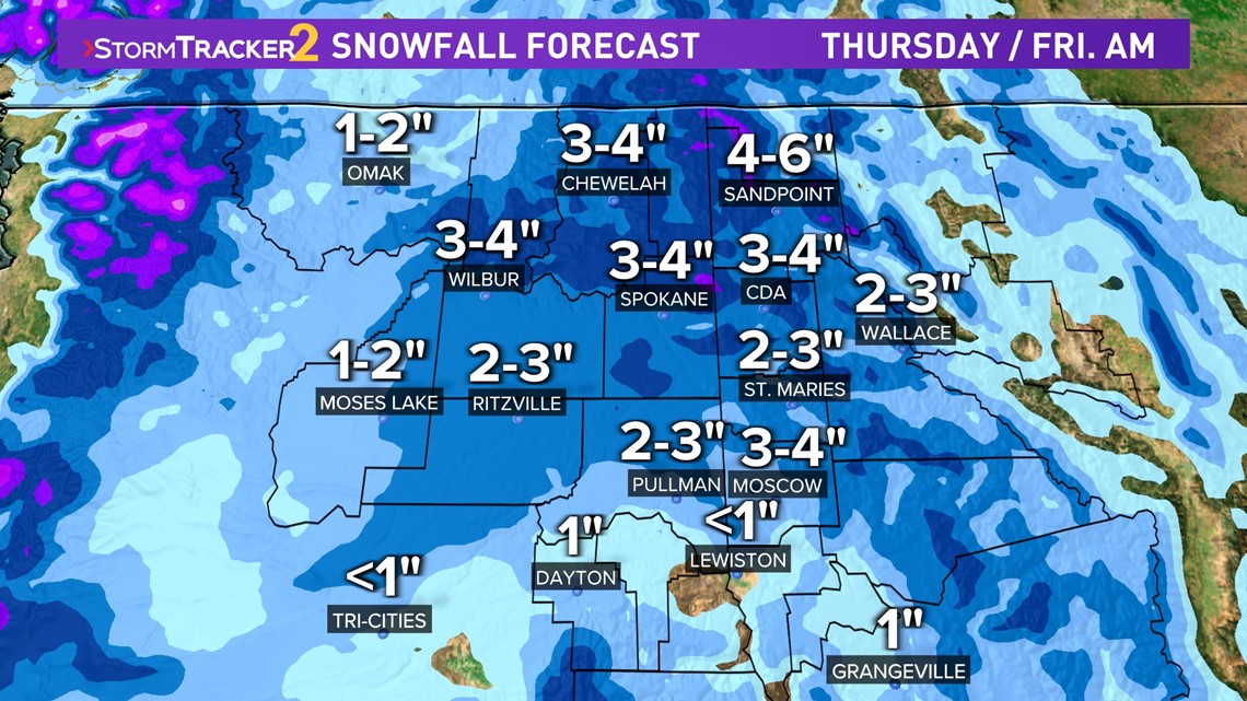
How much snow
- Spokane, Ritzville, and northern Columbia Basin: 3-4" of snow
- Coeur d'Alene, Sandpoint, and northeastern Washington: 3-6" snow
- The Palouse: 2-4" of snow, a little more in Moscow than Pullman
- Omak: 1-2" snow
- Moses Lake: 1-2" snow
- Lewiston: Less than an inch of snow

Travel conditions could be heavily impacted. As usual, we'll see the most focus and resources going to major highways and city arterials. Side streets will get an additional layer of moderate snow on top of the packed snow and ice that remains on them thanks to last week's storm.
Safe to say that side streets are going to stay very snowy and icy for the foreseeable future until significant warming takes place, which is not in the extended forecast.
By the way, another snowfall is likely Saturday for most of the region. Locations in central Washington and warmer locations may get just warm enough to support rain or a wintry mix. Otherwise, it'll once again be wet snowfall.