
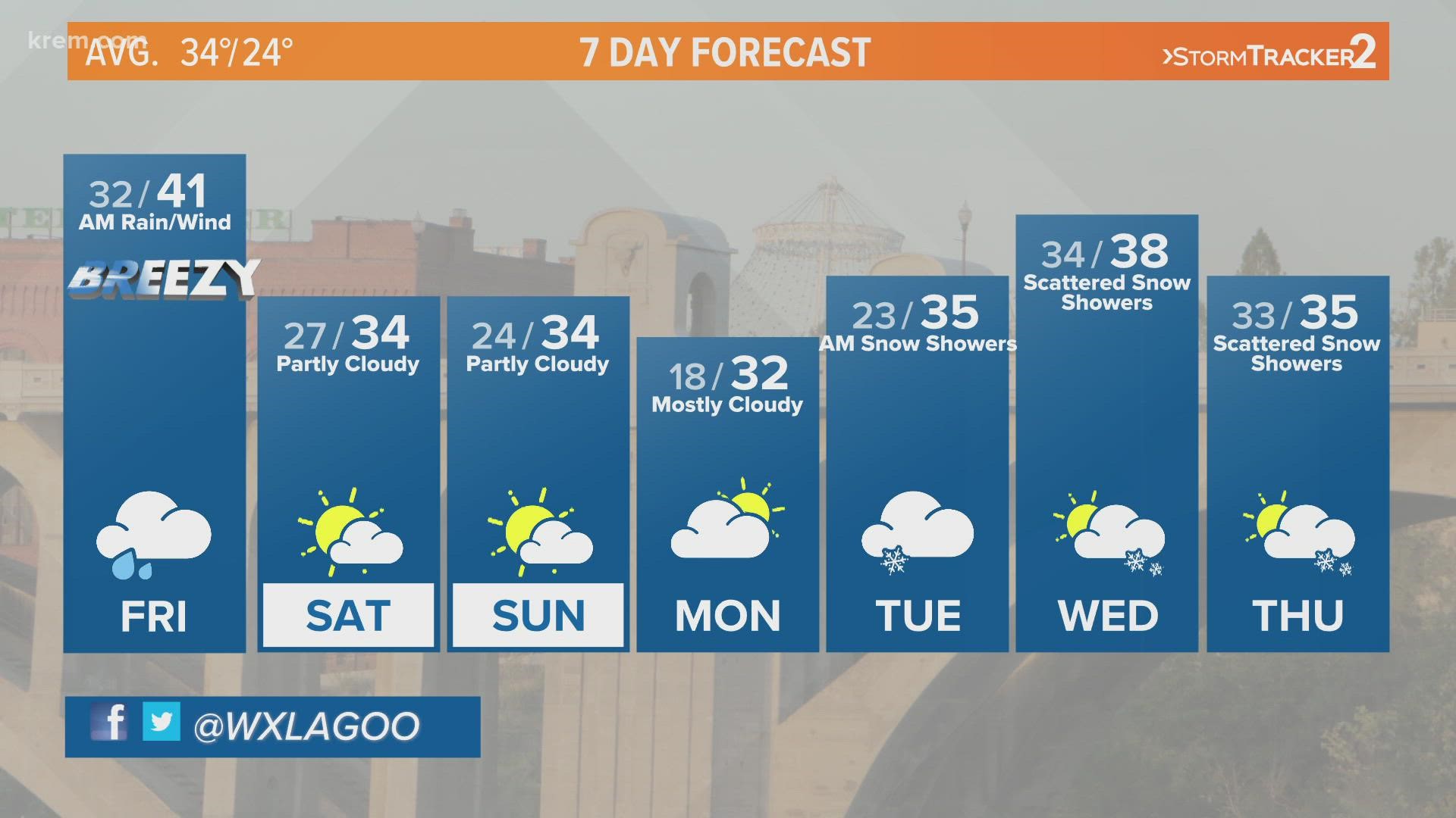
SPOKANE, Wash. — The same storm that brought the heavy snow is now bringing wind, rain and high avalanche danger to the Northwest.
Following the passage of the warm front, the Inland Northwest will be in the warm sector of the storm. That will cause temperatures to soar before the cold front passes and temperatures once again drop below freezing.
Strong southwesterly wind prompted wind advisories and high wind warnings across the Inland Northwest. The wind advisories are in place through 7 pm for the Chelan and Wenatchee area, through the Columbia Basin, into Spokane and Coeur d’Alene and the Palouse. In those areas, the wind will gust at up to 55 miles per hour throughout the day. The high wind warnings remain in place through 7 pm for the Lewis and Clark Valley and Waterville Plateau. In the areas under the warning, the wind will gust at up to 65 miles per hour at times.
The strong wind is what caused temperatures to soar. Warm air advection will continue with the strong southerly wind. Temperatures will climb to near 40 degrees in low elevations and move snow levels up to about 4,000 feet. That means rain and fast-melting snow in low elevations on Friday. It’s likely there will be localized flooding and ponding on roads around Spokane, Coeur d’Alene and the Palouse.
In high elevation areas, the initial onset of light snow turned into wet, heavy snow as temperatures climbed. Heavy snow on light snow is what is known as an inverted snowpack and it is extremely unstable when it comes to avalanche danger. To make matters worse, the strong wind Friday is causing wind loading in addition to the inverted snowpack. Avalanche warnings remain in place for the Cascades and Northern Rockies through Friday due to the danger along roads and in the backcountry in mountain terrain.
Mountain passes remain closed due to the snow and high avalanche danger. Snoqualmie, Stevens, White, and Blewett passes will likely remain closed through Sunday. Conditions are too dangerous in the mountains for crews to work on snow removal or avalanche mitigation.
As the storm exits the region, temperatures will drop. After the cold front passes, Spokane, Coeur d’Alene, the Palouse and Columbia Basin will fall into the 20s. That means all the slush and standing water will freeze Saturday morning. Icy and slick roads, bridges, and sidewalks will be present all weekend long.