
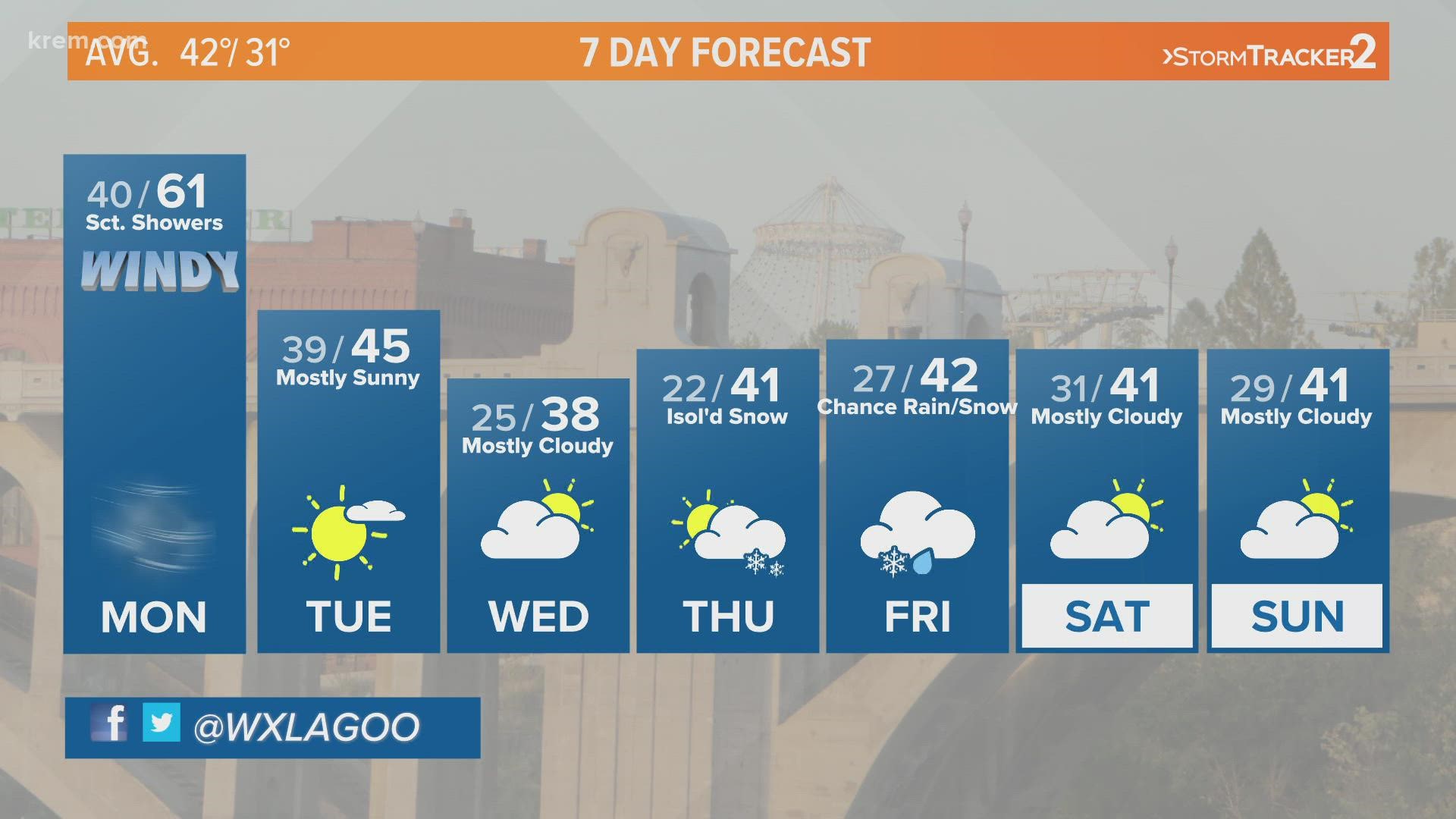
SPOKANE, Wash. — A high wind warning is in place across the Inland Northwest due to damaging gusts starting Monday afternoon. The National Weather Service in Spokane issued high wind warnings and wind advisories in anticipation of the wind event. The warnings and advisories go into effect at 2 p.m. and will last through Tuesday morning.
Following breezy wind Sunday, a passing cold front will bring another round of even stronger wind late Monday and a significant drop in temperatures in the days to come. Wind is expected to remain strong throughout the day ahead of the cold front. The front will hit the Inland Northwest Monday afternoon bringing the start of the strongest wind of the event. Gusts will stay strong through the evening commute and overnight.
The high wind warning stretches from central Washington through Spokane and Coeur d’Alene, down into the Palouse, up and over Lookout Pass and into Western Montana. The wind advisory encompasses areas not in the warning from the eastern side of the Cascades through the Inland Northwest. The warnings and advisories are widespread because the potential for impacts from the wind are widespread.
Strong winds causing damage around Spokane, North Idaho


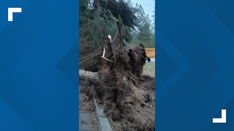


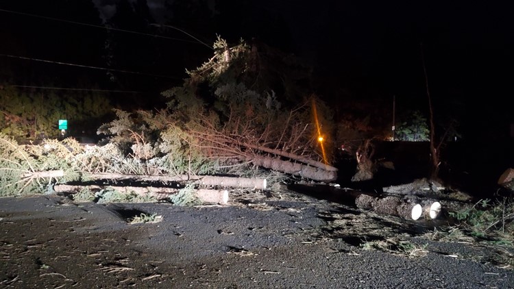


High wind warnings are issued for wind gusts strong enough to cause damage. The wind gusting from 45 to 60 miles per hour Monday afternoon through Tuesday morning will be strong enough to down trees, break tree limbs, and knock out power.
The Storm Tracker 2 Team will keep you up to date with the latest information as the storm develops Monday.