SPOKANE, Wash. — The Inland Northwest is now experiencing rain as temperatures have risen above freezing.
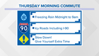
As temperatures rose Thursday morning, freezing rain changed to rain as ice has started to melt in Spokane.
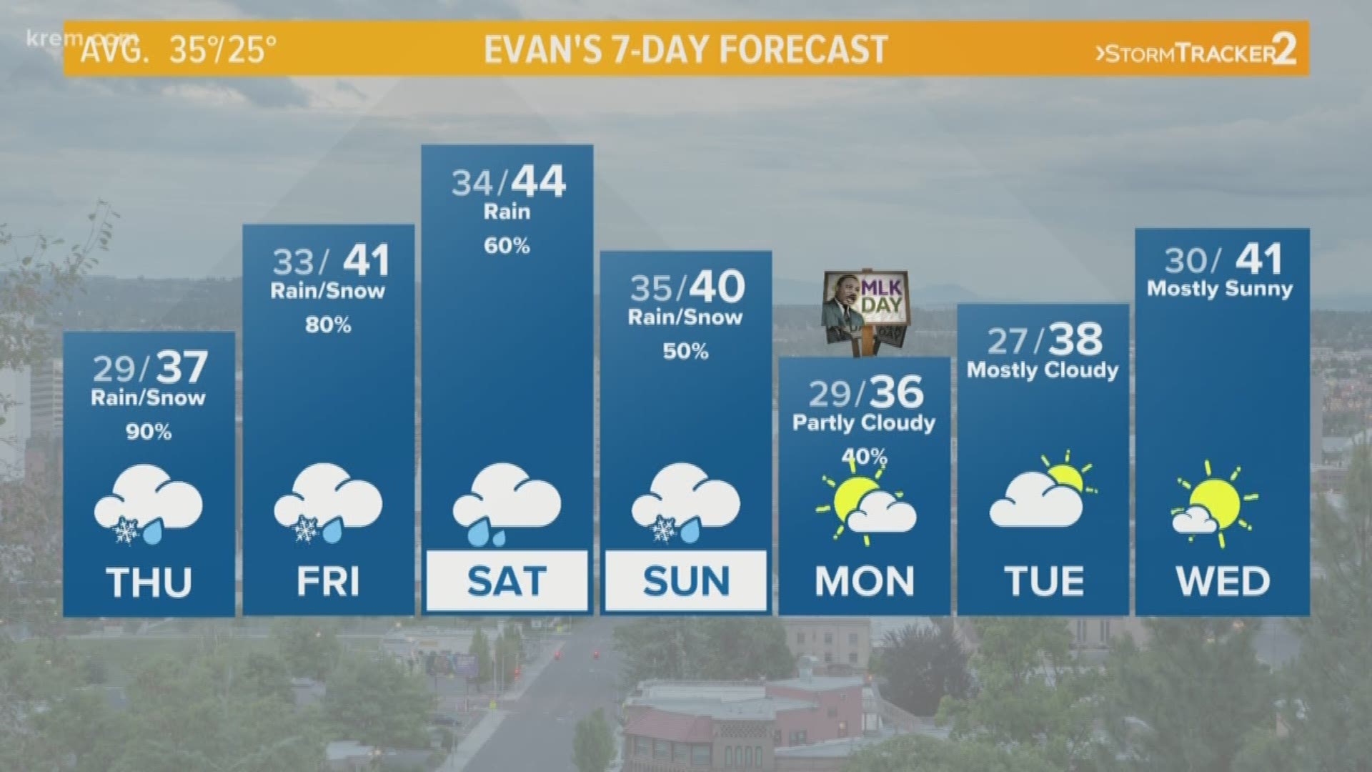
There is a chance we could see a small amount of snow by the end of Thursday, according to KREM Morning Weather Anchor Evan Noorani. The wet weather should clear up by Monday, which many people have off from work and school due to Martin Luther King Jr. Day.
Schools throughout Eastern and Central Washington announced delays on Thursday morning due to poor road conditions. Some school districts in North Idaho are closed for the day. View the latest closings and delays on KREM.com.
Washington State Patrol Trooper Jeff Sevigney reported several crashes throughout Eastern Washington around 6:30 a.m. on Thursday.
Many KREM viewers reported adverse conditions and crashes this morning before the ice started to melt.
Crews began repairs on a traffic light at Sixth and Stevens this morning after a vehicle struck it in the icy conditions.
The drastic change in the weather pattern across the Inland Northwest is expected to last through at least the weekend.
The first impulse brings the threat for freezing rain in the Columbia Basin, and moderate to heavy snow in the northern Washington and Idaho mountains.
Silver Mountain Resort in Kellogg, Idaho, said the forecast is calling for 18 to 23 inches of snow over the next five days, including three to seven inches during the day on Thursday and another three to five inches overnight.
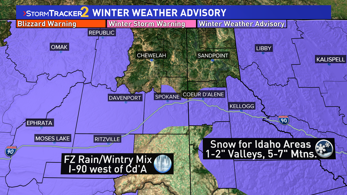
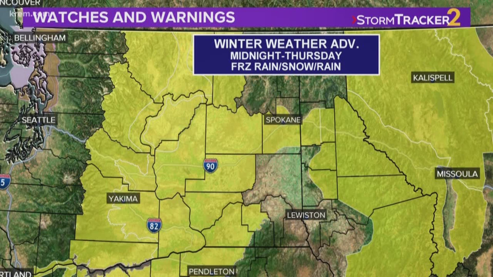
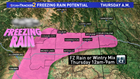
Two separate Winter Weather Advisories have been issued. The first is along the I-90 corridor from Coeur d'Alene and westward through Spokane, Ritzville and Moses Lake until 1 p.m. Thursday. This is for the freezing rain potential. The timing will primarily start after midnight for the lower Columbia Basin, near the Tri-Cities and move into the Spokane/Coeur d'Alene areas between 4 to 9 a.m. Thursday. Ice accumulations will be about .05 inches, perhaps mixing in with a little snow.

The second advisory is for the higher elevations of Idaho through 7 a.m. Friday. This is for snowfall of about 1 to inches in the valleys east of Coeur d'Alene and near St. Maries. The mountains will likely see between 5 to 7 inches of snow. Note the time frame goes all day Thursday through Friday morning, a more prolonged winter weather event for the mountains than in Spokane.

The good news out of all of this is that as temperatures warm into the upper 30s Thursday afternoon, any remaining precipitation will be just rain for Spokane. The ski resorts will also see more beneficial snowfall.